
How to Geolocate a Photo: Verify & Fact-Check Images with AI
In an era of rapid information sharing, the line between truth and fiction is blurrier than ever. For journalists, investigators, and fact-checkers, an image can be a powerful piece of evidence—or a dangerous tool of misinformation. This raises a critical question: How can you be certain where an image was really taken?
Verifying a photo's location, or geolocating, is an essential skill for modern reporting. This guide covers robust methods to find an image's origin, from traditional EXIF data analysis to the advanced AI that is revolutionizing fact-checking. Get the right approach, and you'll confirm locations with confidence and uphold your work's integrity. Want to see how it works? You can analyze your image right now.

Why Photo Location Verification Matters in Journalism
Confirming where a photo was taken is more than a technical exercise; it's a cornerstone of ethical and credible journalism. In a digital landscape filled with manipulated content, location verification provides an anchor to reality, ensuring that the stories you tell are grounded in fact.
The Impact of Misinformation and Deepfakes
Misleading images can sway public opinion, incite conflict, and erode trust in media institutions. A photo taken at one event can be re-contextualized to represent another, completely changing its meaning. The rise of sophisticated editing tools and deepfakes makes this challenge even greater. By geolocating a photo, you can expose these manipulations and prevent the spread of false narratives before they cause harm.
Building Trust: How Geolocation Enhances Credibility
Every verified fact adds a layer of credibility to your reporting. Pinpoint the exact time and place. That gives your audience solid proof they can check themselves. This transparency builds a powerful bond of trust. It shows your commitment to accuracy and distinguishes your work from the unverified claims that flood the internet. Accurate geolocation is a clear signal of rigorous, professional journalism.
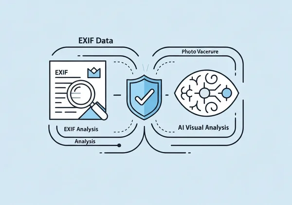
Mastering EXIF Data for Image Fact-Checking
Before diving into advanced technology, every investigator should start with the basics. The most direct clue to a photo's origin is often hidden within the image file itself, in what is known as EXIF data.
What is EXIF Data and Why It's Your First Clue
EXIF stands for Exchangeable Image File Format. It's a type of metadata that most digital cameras and smartphones automatically embed into every picture they take. This data can include:
- Date and time the photo was taken.
- Camera model and settings (like aperture and shutter speed).
- GPS coordinates (latitude and longitude) of where the photo was captured.
For a fact-checker, the GPS information is a goldmine. It can instantly confirm or debunk a claim about a photo's location.
How to Read EXIF Data for Photo Geolocation
Accessing EXIF data is often straightforward. You can use your computer's built-in features (like "Get Info" on macOS or "Properties" on Windows) or use a dedicated online tool. When you find GPS coordinates, you can simply copy and paste them into a mapping service to see the exact location on a map. This is often the quickest way to geolocate a photo.
Limitations of EXIF: When Data is Missing or Tampered
While powerful, EXIF data is not foolproof. There are several key limitations to be aware of:
- Data Stripping: Many social media platforms and messaging apps automatically remove EXIF data when an image is uploaded to protect user privacy.
- Disabled Geotagging: Users can turn off GPS tagging on their devices, meaning no location data is ever recorded.
- Data Manipulation: With the right software, a malicious actor can alter or completely fake the EXIF data, planting false coordinates.
When you encounter an image with no EXIF data, or if you suspect the data has been tampered with, you need a more advanced solution.
AI-Powered Location Analysis: Your Advanced Verification Tool
When metadata fails, visual evidence becomes your primary resource. This is where artificial intelligence transforms the process of photo geolocation. Modern AI skips metadata entirely. It scans images for subtle clues humans might miss. This finds locations from pictures—even without GPS data.
How AI Identifies Locations Without GPS Data
AI-powered tools don't rely on hidden metadata. Instead, they see a photo much like a human investigator would—by looking for identifying features. An advanced AI model can scan an image for millions of visual clues, including:
- Landmarks: Identifying famous buildings, bridges, or natural formations.
- Architectural Styles: Recognizing region-specific building designs.
- Vegetation: Distinguishing types of trees and plants unique to certain climates.
- Signage: Reading text on street signs, storefronts, or billboards.
- Geography: Analyzing terrain like mountains, coastlines, or deserts.
The AI cross-checks these clues against huge geo-databases. It nails down likely spots with impressive accuracy.

Step-by-Step: Using Photo Location Finder for Verification
Tools like Photo Location Finder make it dead simple and show you every step.
- Upload Your Image: Simply drag and drop the photo you need to investigate onto the website.
- Initiate AI Analysis: With a single click, the system begins its work. It first checks for any available EXIF data before launching its deep visual analysis.
- Monitor the Process: The tool shows you its reasoning in real-time, displaying steps like "Scanning for landmarks" or "Analyzing architectural patterns."
- Review the Results: In moments, you'll see the most likely location pinned on an interactive map, complete with coordinates and a confidence score.
This streamlined workflow allows you to get reliable results quickly, saving valuable time during a breaking news situation or a deep investigation.
Interpreting AI Confidence Scores and Visual Clues
A key advantage of a professional-grade tool is transparency. It doesn't just give you an answer; it shows you how it got there. The results include a confidence score, which tells you how certain the AI is about its conclusion.
Furthermore, it lists the specific visual clues it identified in the photo—such as "Eiffel Tower" or "Red sandstone characteristic of the American Southwest." This helps you critically evaluate the findings. You can then integrate them into your own verification process, reinforcing the trust in your conclusions.
Building a Comprehensive Image Verification Workflow
To ensure the highest level of accuracy, journalists and investigators should adopt a multi-layered approach to photo geolocation. Relying on a single method can leave you vulnerable to errors or deception. A comprehensive workflow combines the strengths of both traditional and modern techniques.
Combining EXIF and AI for Robust Fact-Checking
The most effective verification workflow starts with EXIF data and follows up with AI analysis.
- Always Check EXIF First: It's the fastest and most direct source of information. If reliable GPS data is present, your job might be done.
- Verify with AI: Regardless of what the EXIF data says, run the image through an AI tool. If the AI's visual analysis confirms the EXIF location, your confidence in the result should be very high.
- Investigate Discrepancies: If the AI finds a different location or the EXIF data is missing, the AI's visual evidence becomes your primary lead. The transparent reasoning process helps you understand why the AI chose that location.
This hybrid method provides a powerful system of checks and balances for your fact-checking.
Essential Tools for Journalists and Investigators
In a modern digital toolkit, a reliable geolocation tool is as essential as a word processor. You need a partner that delivers accuracy, speed, and transparency—one capable of analyzing visual data at a scale no human can match. I've seen journalists save hours this way. Making an AI tool a standard part of your verification process enhances your reporting and protects you from spreading misinformation.
Enhance Your Reporting with Accurate Photo Geolocation
In the fight against misinformation, accuracy is everything. The ability to geolocate a photo isn't just a technical skill—it's how you report with authority. By combining EXIF data checks with powerful AI analysis, you build a workflow that stands up to scrutiny and protects your credibility.
Skip the guesswork. Get backed up with real evidence. Verify photos now and see how transparent AI can add certainty to your stories.
Frequently Asked Questions on Photo Geolocation
How accurate is AI in finding a photo's location?
The accuracy of AI depends on the quality of the image and the distinctiveness of its visual clues. For photos with clear landmarks or unique geographical features, AI can be incredibly precise. For generic images, like an indoor shot, it may offer a broader region or have a lower confidence score. High-quality tools are transparent about this uncertainty.
Can I verify photos without any EXIF data?
Yes. This is where AI-powered tools are most valuable. By analyzing visual content alone—from architecture to vegetation—an AI can identify a location even when metadata has been stripped. This is essential for verifying images found on social media. Tools like ours make it simple to geolocate a photo using only visual clues.
What are the common challenges in geolocating a photo?
Common challenges include poor image quality, lack of unique identifying features, and deliberate manipulation of visual elements. Additionally, locations can change over time, so an older photo may not perfectly match current satellite imagery, requiring further historical investigation.
How can Photo Location Finder help with journalistic fact-checking?
A good geolocation tool for journalists should be fast, accurate, and transparent. Look for a hybrid engine that checks both EXIF data and visual clues. The best systems show their work—listing the specific evidence behind a conclusion. This provides the verifiability you need to report with confidence.